


NEWBERRY TWP DIST 02, York County, Pennsylvania
About
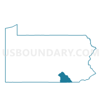
Outline

Summary
| Unique Area Identifier | 664729 |
| Name | NEWBERRY TWP DIST 02 |
| County | York County |
| State | Pennsylvania |
| Area (square miles) | 6.99 |
| Land Area (square miles) | 6.87 |
| Water Area (square miles) | 0.12 |
| % of Land Area | 98.24 |
| % of Water Area | 1.76 |
| Latitude of the Internal Point | 40.11054090 |
| Longtitude of the Internal Point | -76.73791290 |
Maps


Graphs
Select a template below for downloading or customizing gragh for NEWBERRY TWP DIST 02, York County, Pennsylvania


Neighbors
Neighoring Voting District (by Name) Neighboring Voting District on the Map
- CONEWAGO TWP DIST 02, York County, PA
- CONOY TWP Voting District, Lancaster County, PA
- EAST MANCHESTER TWP Voting District, York County, PA
- LONDONDERRY TWP DIST 02, Dauphin County, PA
- NEWBERRY TWP DIST 01, York County, PA
- YORK HAVEN Voting District, York County, PA
Top 10 Neighboring County Subdivision (by Population) Neighboring County Subdivision on the Map
- Newberry township, York County, PA (15,285)
- Conewago township, York County, PA (7,510)
- East Manchester township, York County, PA (7,264)
- Londonderry township, Dauphin County, PA (5,235)
- Conoy township, Lancaster County, PA (3,194)
- York Haven borough, York County, PA (709)
Top 10 Neighboring Place (by Population) Neighboring Place on the Map
Top 10 Neighboring Unified School District (by Population) Neighboring Unified School District on the Map
- West Shore School District, PA (62,415)
- Elizabethtown Area School District, PA (30,068)
- Lower Dauphin School District, PA (24,736)
- Northeastern York School District, PA (23,371)
Top 10 Neighboring State Legislative District Lower Chamber (by Population) Neighboring State Legislative District Lower Chamber on the Map
- State House District 47, PA (75,494)
- State House District 92, PA (68,932)
- State House District 98, PA (65,433)
Top 10 Neighboring State Legislative District Upper Chamber (by Population) Neighboring State Legislative District Upper Chamber on the Map
- State Senate District 28, PA (284,462)
- State Senate District 48, PA (278,934)
- State Senate District 15, PA (266,253)
Top 10 Neighboring 111th Congressional District (by Population) Neighboring 111th Congressional District on the Map
- Congressional District 19, PA (728,630)
- Congressional District 16, PA (723,977)
- Congressional District 17, PA (681,835)
Top 10 Neighboring Census Tract (by Population) Neighboring Census Tract on the Map
- Census Tract 208, York County, PA (7,510)
- Census Tract 209.21, York County, PA (7,107)
- Census Tract 210.20, York County, PA (6,411)
- Census Tract 209.10, York County, PA (6,306)
- Census Tract 240.01, Dauphin County, PA (6,142)
- Census Tract 108.02, Lancaster County, PA (3,194)
Top 10 Neighboring 5-Digit ZIP Code Tabulation Area (by Population) Neighboring 5-Digit ZIP Code Tabulation Area on the Map
- 17057, PA (21,329)
- 17319, PA (10,417)
- 17345, PA (7,679)
- 17347, PA (6,202)
- 17370, PA (5,683)
- 17502, PA (2,464)